


'Out of energy' Klopp to quit as Liverpool manager at end of season


At A Glance
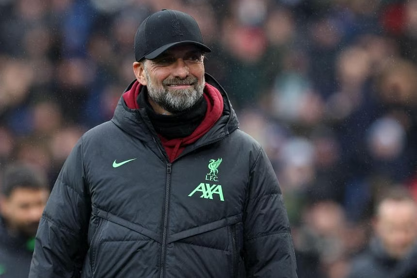
- Liverpool manager Jurgen Klopp shocked the football world on Friday, Jan. 26, by announcing he will leave the club at the end of the season because he is "running out of energy".
LIVERPOOL (AFP) -- Liverpool manager Jurgen Klopp shocked the football world on Friday, Jan. 26, by announcing he will leave the club at the end of the season because he is "running out of energy".
Klopp, who has restored Liverpool to one of European football's powerhouses since taking over at Anfield in 2015, said the decision was taken after realizing his "resources are not endless".
The 56-year-old plans to take at least a year's sabbatical from management come May and promised to Liverpool fans that he will never coach another English club.
"I can understand that it's a shock for a lot of people in this moment, when you hear it for the first time," Klopp said in an interview on Liverpool's website.
"I love absolutely everything about this club, I love everything about the city, I love everything about our supporters, I love the team, I love the staff. I love everything. But that I still take this decision shows you that I am convinced it is the one I have to take.
"It is that I am, how can I say it, running out of energy."
Klopp led Liverpool to their first league title for 30 years in 2020 and to Champions League glory in 2019 among seven trophies during his time at Anfield.
He could add a few more in the coming months as he aims to go out on a high.
Liverpool is five points clear at the top of the Premier League, face Chelsea in the League Cup final next month and is still involved in the FA Cup and Europa League.
Klopp said he had taken the decision in November when discussions with the club about potential signings for next season began.
After years of battling with Manchester City at the top of the Premier League and reaching the later stages of the Champions League, Liverpool struggled to match their usual standards under Klopp in the 2022/23 season.
But Klopp said it was vital for him to not leave on that sour note.
Guardiola to 'sleep better'
"For me it was super, super, super-important that I can help to bring this team back onto the rails. It was all I was thinking about," said Klopp on Liverpool's return to form this season.
"When I realized pretty early that happened, it's a really good team with massive potential and a super age group, super characters and all that, then I could start thinking about myself again and that was the outcome. It is not what I want to (do), it is just what I think is 100 percent right."
Klopp has spoken in the past of his desire to manage the German national team, but he hinted that those ambitions will be put on hold until he is refreshed.
"Whatever will happen in the future I don't know now but no club, no country for the next year. No other English club ever, I can promise that," he added.
Klopp's biggest rival during his reign has been Manchester City boss Pep Guardiola, who saluted the German after his side's FA Cup victory at Tottenham on Friday night.
"Of course he will be missed. It was a shock to everyone. At Manchester City, we cannot define our period without him," Guardiola said.
"He is the best rival I have had in my career. I will sleep better. Before playing against Liverpool was always a nightmare!"
The US-based Fenway Sports Group (FSG), who own Liverpool, paid tribute to Klopp and said work will begin immediately on looking for his successor.
Xabi Alonso, the Spanish former Liverpool player who has guided Bayer Leverkusen to the top of the Bundesliga this season as coach, is the bookmakers' favorite.
Brighton boss Roberto De Zerbi is also in the running after leading the Seagulls into Europe this season for the first time.
"It goes without saying that we will be hugely saddened to lose not just a manager of such caliber, but a person and leader for whom we have enormous respect, gratitude and affection," said FSG president Mike Gordon.
Klopp's first match since the bombshell news comes against Norwich in the FA Cup fourth round at Anfield on Sunday.
Norwich is fitting opponents as it is managed by Klopp's friend David Wagner, who was best man at the wedding of the Reds boss.
"I wasn't surprised when he told me," Wagner said. "It shows a lot of personality, character and bravery as well. We all know how exhausting and how challenging this business can be."