


62 houses razed in Mandaue City fire


CEBU CITY – At least 62 houses were razed in a fire that broke out in Barangay Basak, Mandaue City at noon on Thursday, May 23.
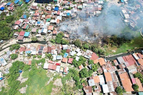
MORE than 60 houses were razed in a fire in Barangay Basak, Mandaue City at noon on Thursday, May 23. (Photo courtesy of MyTVCebu)
The fire started at 11:54 a.m. and was controlled in 49 minutes.
The fire displaced at least 96 families. Damage to property was pegged at P280,000.
According to the Bureau of Fire Protection-Mandaue, the fire started in Purok Alliance of Two Hearts and spread to Sitios (sub-village) Santan and Saging-saging.
Nearby firefighters responded after the fire was raised to second alarm.
Cause of the fire is still being investigated. There were reports that some residents were injured while trying to save their belongings.
Due to the extremely high heat index, authorities advised the public to take extra precautions to prevent fire incidents.