


 Entertainment
Celebrities
Korean action thriller 'No Way Out: The Roulette' set for release on Disney+
Entertainment
Celebrities
Korean action thriller 'No Way Out: The Roulette' set for release on Disney+
Korean action thriller 'No Way Out: The Roulette' set for release on Disney+


The Korean action thriller “No Way Out: The Roulette” starring Cho Jin-woong, Yoo Jae-myung, Kim Mu-yeol and Yun Jung-ah will be coming to Disney+ this month.
After serving 13 years for committing a series of heinous crimes, Korea’s most hated man, murderer Kim Gukho (Yoo Jae-myung), is released on parole.
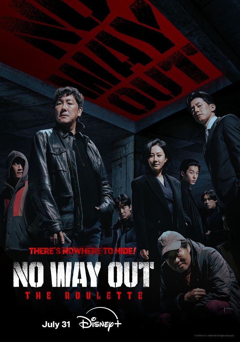
“No Way Out: The Roulette” is coming to Disney+ on July 31 (Disney+)
“No Way Out: The Roulette” will star (clockwise from top left) Yoo Jae-myung, Cho Jin-woong, Yun Jung-ah, Hsu Kwanghan aka Greg Hsu, Kim Sung-cheol, Kim Mu-yeol and Lee Kwang-soo (Studio X+U)
Outraged by his release, one mysterious citizen offers a 20 billion won ($14 million) bounty to anyone who can track down and kill the notorious criminal. Targeted by a growing number of desperate citizens, Kim Gukho will have to put his faith in his police protection team if he hopes to survive.
The series also stars Cho Jin-woong (“Signal”) as police officer Baek Joongsik; Kim Mi-yeol (“Grid”) as Lee Sangbong; Yum Jungah (“Sky Castle”) as Ahn Myeongja; Sung Yubeen (“Mr. Sunshine”) as Kim Dongha; Hsu Kwanghan aka Greg Hsu (“Marry My Dead Body”) as Mr. Smile; Lee Kwang-soo (“Sinkhole”) as Yoon Changjae and Kim Sung-cheol (“Our Beloved Summer”) as Seong Junu.
It is produced by Studio X+U, written by Lee Sujin (“The Devil’s Deal”) and directed by Choi Kookhee (“Default”) and Lee Hubin.
“No Way Out: The Roulette” will premiere on Disney+ on July 31.